


Introduction to the Plan of the Upper Odra River Sub-Basin
Herewith presented an updated Plan of the Upper Odra River Sub-Basin determines the future direction of water management of the basin for the years 2021 till 2027.
Already our ancestors realised that the Czech Republic is „the roof of Europe” and since the country has only limited water resources it is necessary that they are managed and protected with great care. Developments in the field of water management began to be gradually regulated, first by the National Water Management Plan and Water Act, that was recently supplemented by the Directive of the European Parliament and the Council 2000/60/EC of the year 2000, establishing a framework for the Community activities in the field of water policy (i.e. Water Framework Directive) and the Directive of the European Parliament and Council 2007/60/EC of 2007 on the assessment and management of flood risks (i.e. Floods Directive).
Thus, as may be apparent, the water management is seeking greater symbiosis with protection of nature, which has gained a great importance in the recent times, and also the social aspect which endeavours to maintain and increase the possibility of further living standards of the European population. Loosely put, it concerns the humanization of the whole profession. The developer of the plan, i.e. the state-owned enterprise Odra River Basin, believes that it is necessary to adhere to the established procedures that the development of new water works should take cognisance of nature friendly practices and in this regard even the existing water works be modified. However, it would be short-sighted, irresponsible or even dangerous to leave the complex utilization of water resources in a time when mankind was, is and will be exposed to extreme weather conditions such as drought and floods.
Apart of the provided description and characteristics, the Plan of the Upper Odra River Sub-Basin made use of the water monitoring processes, assessed water conditions, reviewed measures implemented in the second planning period of 2016 to 2021 and proposed measures ensuring that the water quality would improve rather than deteriorate in the future. The planning included the evaluation of areas with major flood risks and production of maps of flood hazards and risks. All of these documents serve as a basis for the determination of happenings in the field of water management in the Moravian-Silesian region and Olomouc region and a basis for the preparation of the National Plan for the Odra River Basin and a Plan for the Flood Risk Management in the Odra River Basin, which were used for the creation of the International Water Plan.
The Basin Plan was developed by the state-owned enterprise Odra River Basin in cooperation with the Regional Authority of the Moravian-Silesian and Olomouc regions in cooperation with the Central Administration Offices and with the help of the main contractor, the company AQUATIS a.s. Brno. The evaluation of the water status was carried out by the Water Research Institute T.G.M., v.v.i. The Plan’s creation was also assisted by the state-owned enterprise Lesy CR as well as the Agency for Nature Conservation and Landscape Planning, members of the Commission for the Upper Odra River Sub-basin, water supply and sewerage companies operating within the area and other public parties.
The Plan of the Upper Odra River Sub-Basin and maps and documentation ensures compliance with the basic requirements of the European Directives and national laws and thus prevents deterioration of the water status. It ensures limitation of risks of adverse consequences associated with floods and droughts and gradual achievement of a good water quality with elimination of priority substances in the water. It helps to ensure good quality drinking water for the public and ultimately contributes to the achievement of the concentration of substances in the marine environment that are near to their naturally occurring values.
Actions proposed by the Plan deal with the following:
- water retention in a landscape (Institute of Complex Land Alterations, pools)
- new retentions facilities (polders, small water reservoirs)
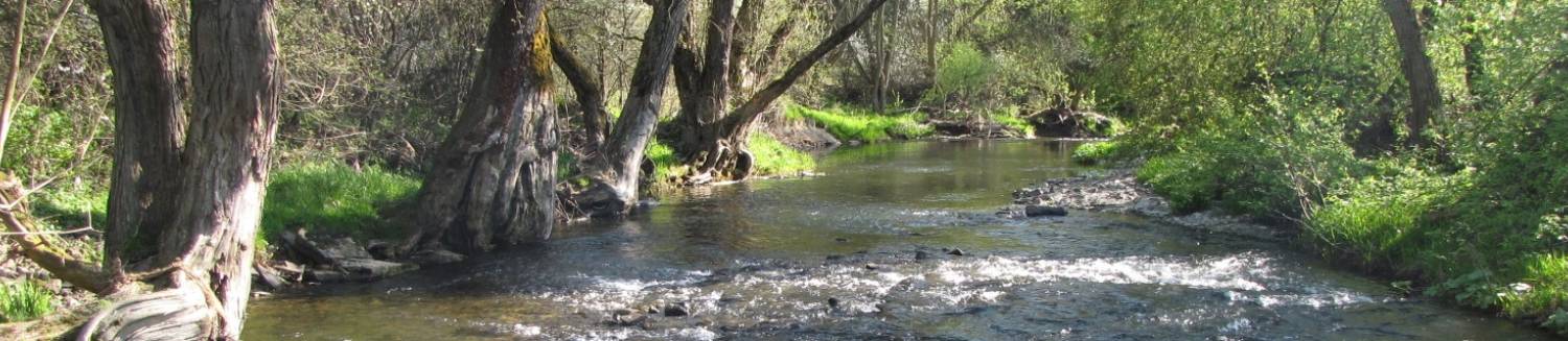
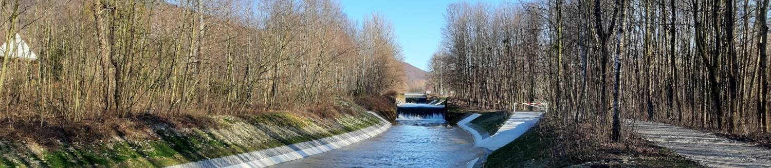
- retarding drainage of water (river systems revitalization)
- flood protection measures (in particular via the river spaced dykes in order to create new retention areas and slowing down flood waters by means of the revitalization)
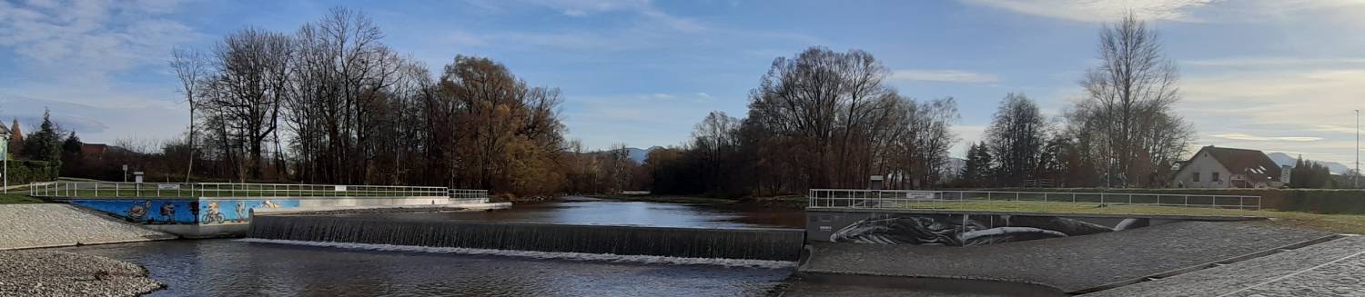
- further improvement of water quality together with the improvement of living conditions for organisms linked to the aquatic environment (revitalization, fish ladders, wastewater treatment plants and sewerage systems)
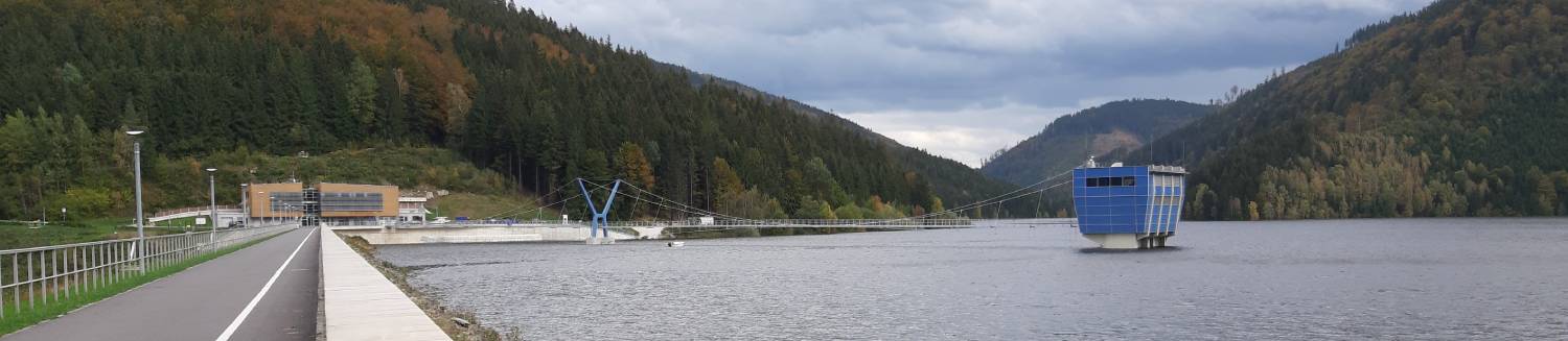
- increasing the security of water works (upgrading large dams and river dykes together with an increase of the technical and safety supervision thereof)
- making good and the prevention of mining damages (alterations to dykes, riverbeds and water structures built there on)
- old contaminated sites (progressive reclamation work for the improvement of the status of groundwater)
- prevention, mitigation of droughts and floods (expansion of water management infrastructure, good management practices, floodplains, the River Basin Administrator’s statements activity, etc.)
A major task for Municipalities of towns and villages is to nurture, enhance and restore drainage conditions of roads, drainage ditches and gutters, i.e. runoffs, infiltration and drainage infrastructure of towns and villages. An important aspect of this activity is to gradually solve the ownership issues and assign owners to the individual structures influencing runoff conditions who will both enjoy their rights and fulfil their responsibilities as owners as per the relevant laws.
It appears to be a priority to further improve the chemical and biological status of water including both the reducing of the pollutant discharged into waterways and gradual improvement of the migration passages through barriers at the main water courses of the Upper Odra River Sub-Basin for fishes and other aquatic organisms, but mostly to continue with the development and implementation of flood protection measures on the Upper Opava River without forgetting the enhancement of strength of the existing dams.
The Plan of the Upper Odra River Sub-Basin and other related plans were discussed and approved by the relevant regions, i.e., representatives of the Moravian-Silesian Region and Olomouc Region.
We hope that the above documentation will be a good guideline for our endeavours to develop optimal water structures for these demanding times. The attached Plan of the Upper Odra River Sub-Basin includes a brief summary, which should guide the wider public through the final version of the documents, allow easier appreciation of its contents and clarify the significance of the proposed measures directed towards the achievement of good water quality.
All planning documents and the complete Plan of the Upper Odra River Sub-Basin are available in electronic form on the following websites or at the addresses:
- Povodí Odry, státní podnik (Odra River Basin, state enterprise), Varenská 49, 701 26 Ostrava, Department of Water Management Concepts and Information,
Ing. Pavlas, tel.: +420 596 657 266, www.pod.cz/planovani, e-mail: planovani@pod.cz. - Krajský úřad Moravskoslezského kraje (Regional Office of the Moravian-Silesian Region), 28. října 117, 702 18 Ostrava, Department of Environment and Agriculture,
Ing. Bc. Heczková, tel.: +420 595 622 683, e-mail: lenka.heczkova@msk.cz. - Krajský úřad Olomouckého kraje (Regional Office of the Olomouc Region), Jeremenkova 40a, 779 11 Olomouc, Department of Environment and Agriculture,
Ing. Breškovcová, tel.: +420 585 508 405, e-mail: j.breskovcova@olkraj.cz.
www.pod.cz